Rule 1501:14-1-12 | Maps: general requirements, uniform color code and map symbols.


(A) Submit maps along with permit applications, renewal applications, and annual and final reports, as required by Chapter 1514. of the Revised Code and these rules, except that a map need not be submitted along with the annual report if there has been no affectment of the land surface or the mining area has not expanded laterally during the year, and no additional affectment of the land surface or lateral expansion of the mining area is expected during the next year.
(B) All acreage figures required to be reported or estimated by Chapter 1514. of the Revised Code or these rules shall be to the nearest one-tenth of an acre.
(C) All maps required by Chapter 1514. of the Revised Code and these rules shall conform to the following standards:
(1) Submitted in triplicate, except that at the time of initial filing of an application for a surface mining permit, only two copies of the application map need be submitted;
(2) Locate the north direction at the top of the map, designated by an arrow in the upper left hand corner of the map;
(3) Drawn to a scale of the map either one inch equals one hundred feet, one inch equals two hundred feet, one inch equals three hundred feet, or one inch equals four hundred feet, as is sufficient for the map to show the requirements of division (A)(11) of section 1514.02 of the Revised Code;
(4) Include a contour interval of the map at two feet, five feet, ten feet, or twenty feet, as is adequate to show the topographic relief of the proposed area;
(5) Place the quadrangle sketch, not to exceed six inches by six inches, in the upper right hand corner of the map and identify sufficient landmarks to locate the permit area or the proposed permit area, and include the name of the quadrangle utilized;
(6) Place a legend below the quadrangle sketch, which will utilize the symbols described in paragraph (F) of this rule;
(7) Include a notarized certification made by the preparer of the map, placed below the legend. The certification shall be signed and attested to before a notary public, and read: "I, the undersigned, hereby certify that this map is correct, and shows to the best of my knowledge and belief all the information required by the surface mining laws of the state."
(8) Place a title block in the lower right hand corner of the map, and include the following information if applicable:
(a) The title of the map, i.e. application, amendment, renewal, annual, progress, final, or reclamation;
(b) The name of the applicant or permittee;
(c) The permit number;
(d) The township and range designation;
(e) The location coordinates of the approximate geographical center of the proposed or existing permit site, be given in state plane coordinates, derived from the appropriate 7.5 minute U.S.G.S. topographic map, or latitude and longitude;
(f) The name of the township and county;
(g) The section, lot, or survey numbers;
(h) The scale and contour interval of the map;
(i) The date when the map was prepared or, when applicable, the dates when it was prepared and revised; and
(j) The municipal corporation.
(D) In addition to the requirements of paragraph (C) of this rule, include the following for all annual maps, final maps, and renewal maps:
(1) A summary, by mining area and for the permit area, in the chronological order in which it occurred, the number of acres affected to date and the number of acres to be reclaimed;
(2) A listing, for each mining area and for the permit area, of the acres estimated to be affected during the next year; and
(3) A listing for the permit area of: the acres that have had a grading release but not a planting release; the acres that have had a planting release; the acres that have had a total bond release; and the acres previously released that are now reaffected.
(E) All maps required by Chapter 1514. of the Revised Code or these rules shall utilize the following uniform color code:
(1) Designate the perimeter of the proposed or existing permit area with a solid black line highlighted in yellow;
(2) Designate the area proposed in an amendment by a solid black line, with its area shaded yellow, and the perimeter of the existing permit area designated by a solid black line highlighted in yellow;
(3) Designate the perimeter of the cumulative area actually affected by a solid orange line;
(4) Designate the perimeter of the area to be reclaimed, i.e., area on which mining has been completed during the permit year, with a solid red line;
(5) Designate the perimeter of the area estimated to be affected during the next permit year, including areas to be reaffected, by a dashed red line, with the areas to be reaffected shaded in orange;
(6) Any area which has been shown to be reclaimed on a previous map but has not had a performance bond release shaded pink;
(7) When more than one mining area exists within a permit area, identify each by name or number;
(8) Record the number of the permit year in which an area was reported to be reclaimed, in paragraph (E)(4) of this rule, in such area;
(9) Designate any area upon which grading, contouring or terracing, and resoiling has been completed and a performance bond release request is being submitted by purple cross-hatching;
(10) Designate any area upon which permanent planting or a permanent water impoundment has been completed and a performance bond release request is being submitted by green cross-hatching;
(11) Shade any area upon which grading has been released, but not planting, purple;
(12) Designate any area upon which all performance bond has been released by black cross-hatching;
(13) Shade any area to be deleted from the permit, green;
(14) Designate the perimeter of any area of topsoil, subsoil, or suitable substitute resoiling material storage with a dashed black line, and shade the area included therein brown; and
(15) Show existing and proposed sediment ponds and permanent impoundments on the map and identified by name or number.
(F) Utilize the following uniform symbols for all maps and drawings required by Chapter 1514. of the Revised Code or these rules:
Permanent impoundments

Sediment ponds

Existing bodies of water

Spillway

Overflow pipe (show inside diameter)

Electric distribution line

Electric transmission line (5kv or greater)
Telephone

Gas line

Oil line

Water line

Occupied building

Unoccupied building

Mineral outcrop line
Final highwall

Beginning point
Ending point

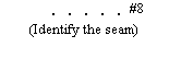
Direction arrow (to show how mining will proceed)

Test holes

Contour lines

Property lines

Dike

Diversion ditch

Natural drainage

Pumped drainage

Natural drainage (intermittent flow)

Haul road
Hard surface road

Gravel road or driveway

Oil well

Gas well

Water well

Deep mine shaft

Drift or slope mine entry

Areas to be planted in trees (only needed if entire area is not to be planted in trees)

Existing highwall or active mining face

Toe of spoil or overburden

Cross section

Proposed spoil area

Sump

Last updated February 1, 2024 at 8:26 AM
Supplemental Information